The Advanced Spaceborne Thermal Emission and Reflection
Radiometer (ASTER) instrument has been flying in space on the Terra platform
since its launch in 1999. Not bad for a satellite which had an expected
lifespan of five-years. Hopefully it will continue into the foreseeable future.
The instrument acquires images in visible, near infrared, and thermal infrared
wavelengths (TIR). The spatial resolution range from 15 to 90 meters. ASTER
spans +- 83 degree latitudes, and covers 99 percent of earth's landmass.
ASTER also produces one of the high resolution elevation dataset (30m).
Recently, NASA released the complete archive (2.95 million
images) of Earth's thermal infrared images to the public with unlimited access.
Previously, users could access ASTER's global digital topographic maps for
free, however, other ASTER data products were available at nominal fee paid to
Japan’s Ministry of Economy, Trade and Industry (METI).
ASTER has been used to study, map, and monitor the
ever-changing surface of our planet Earth. Some of the products and application
of ASTER data include surface mapping and monitoring of changes in surface
properties such as glacial advance/retreat, volcanism, crop stress, cloud
properties, wetlands, coral reef degradation, land surface temperature, surface
geology, etc.
A good selection of ASTER images can be found on the ASTER
web site, gallery pages:
The dataset is available at:
We stopped by the office of Dr. Mike Abrams, the project
leader for ASTER science team at NASA JPL.
Here are 5 quick questions with him:
1. Please share your experience with the ASTER project.
I have been involved with the ASTER project since its
inception in 1988 as part of NASA’s Earth Observing System (EOS) program.
Working with my Japanese colleagues and traveling to Japan has been an
enriching inter-cultural experience. Added to that is the satisfaction of the
success of our 16-year joint mission
2. Why are the millions of ASTER images being made public?
In Japan, oversight of the ASTER project was transferred
from one organization to another. The new operator is part of Japan’s National
Science Institutes. Jointly, with NASA, the decision was made to eliminate
charging for all ASTER data.
3. How can users get maximum use out of the ASTER data?
Natural color, full resolution JPEG images can be downloaded
for all images in the archive. No sophisticated software is needed to view
these images. (https://lta.cr.usgs.gov/terralook/home).
To do more in-depth analyses, the digital data must be downloaded, then
analyzed with GIS or image processing software.
4. What are the unique feature of ASTER? (Some examples of
news for societal benefit.)
Our high resolution, global Digital Elevation Model (DEM)
data set is unique. It is the only topographic data freely available to all
users covering the land surface of the Earth at 30m resolution. We have a
vigorous monitoring program of 1500+ active volcanoes, and 100,000+ glaciers,
looking for time-dependent change. We also acquire many images for
post-disaster mitigation, like damage from tsunamis.
5. Do you have favorite image(s) of ASTER?
See the interview with National Geographic: http://news.nationalgeographic.com/2016/04/160406-pictures-nasa-terra-aster-satellites-space-science/
 |
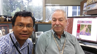
| A selfie with Dr. Abrams. |
Note: I had an opportunity to be a co-author with him on the paper:
The ASTER Global Emissivity Dataset (ASTER GED): Mapping Earth's emissivity at 100 meter spatial scale,
GC Hulley, SJ Hook, E Abbott, N Malakar, T Islam, M Abrams
Geophysical Research Letters 42 (DOI: 10.1002/2015GL065564)
http://onlinelibrary.wiley.com/doi/10.1002/2015GL065564/full


