Nabin K. Malakar, Ph.D.

NASA JPL
I am a computational physicist working on societal applications of machine-learning techniques.

Research Links

My research interests span multi-disciplinary fields involving Societal applications of Machine Learning, Decision-theoretic approach to automated Experimental Design, Bayesian statistical data analysis and signal processing.

Linkedin


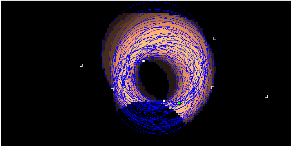
Interested about the picture? Autonomous experimental design allows us to answer the question of where to take the measurements. More about it is here...

Hobbies

I addition to the research, I also like to hike, bike, read and play with water color.

Thanks for the visit. Please feel free to visit my Weblogs.

Welcome to nabinkm.com. Please visit again.

Showing posts with label conference. Show all posts

Wednesday, May 25, 2016

Special Issue "Sustainability in the Mountains Region"


Mountains are a part of the global biodiversity repository, play a vital role in maintaining global ecosystems, while supporting millions of people. In the meantime, they are the most vulnerable ecosystems. Changes in the environment and economic priorities in past few decades have considerably influenced the livelihood and sustainability of mountains globally. The effects of changing climate and other socioeconomic factors on mountains can affect the densely populated and underdeveloped regions to an inconceivable scale. It is, therefore, important that we study the impacts of climate change, changes in economic priorities of the mountain residents, and increasing non-conventional values of mountain ecosystems and its inhabitants. Moreover, the factors affecting the sustainable livelihood of mountain inhabitants need to be carefully studied to assess the short and long-term impacts, and to develop a long-term strategy for improving the livelihood of the residents in the face of the changes.
This Special Issue will feature peer-reviewed papers from the international conference on “Mountains in the Changing World (MoChWo)”, to be held in Kathmandu, Nepal, on 1–2 October, 2016 (http://conference.kias.org.np). The conference and the Special Issue aim to provide a forum for international/national scholars, researchers, policy makers, and students with an opportunity to share their research findings and knowledge related to various aspects of mountains.  
The range of relevant topics include:
  • Environmental, economic and social sustainability
  • Land use and land cover monitoring, natural disaster and risk assessment
  • Decision making and societal impacts, policy and management strategies for sustainable development
  • Citizen science and trainings
  • Remote sensing, and mapping of resources
  • Data fusion, and data visualization relevant to sustainability issues
  • Innovation in renewable and alternative energy
  • Pesticide uses and sustainable agriculture
  • Organic farming
We welcome papers from broadly defined topics that are relevant to the theme of the Special Issue.
Dr. Nabin K Malakar
Dr. Rajan Ghimire
Dr. Jhalendra Rijal
Dr. Pradeep Wagle
Guest Editors
-->

Saturday, July 19, 2014

Presented at IGARSS 2014, Quebec, Canada

This week I attended the joint International Geoscience and Remote Sensing Symposium (IGARSS 2014) / 35th Canadian Symposium on Remote Sensing (35th CSRS).  The symposium theme was “Energy and our Changing Planet”.

ON Friday I presented my work on:
Assessing MODIS C006 urban corrections using the High Resolution Dragon AERONET Network
http://igarss2014.org/Papers/viewpapers.asp?papernum=3464

The slides are embedded below for viewing:

Friday, March 28, 2014

Presenting in Machine Learning Conference in NYAS today


Creating High-Resolution Climate Meteorological Forecasts by Application of Machine Learning Techniques

Nabin Malakar, PhD, Emmanuel Ekwedike, BS, Barry Gross, PhD, Jorge Gonzalez, PhD, and Charles Vorosmatry, PhD
The City College of New York, New York, New York, United States;

In order to study the effects of global climate change on a regional scale, the low resolution GCM forecast data needs to be intelligently adapted (downscaled) so that it can be injected into high resolution models such as terrestrial ecosystems. Our study region is the North East domain [{35N, 45N} x {-85W,-65W}]. In particular, we focus on High and Low temperature extremes within the Daymet data set, while the low resolution climatology (at 0.5 deg) MET data are obtained from the The Inter-Sectoral Impact Model Intercomparison Project (ISI-MIP) climatology forecast database.  Although the injection of regional Meteorological Models such as Weather Research and Forecasting (WRF) can be attempted where the GCM conditions and the forecasted land surface properties are encoded into a future time slices, this approach is extremely computer intensive. We present a two-step mechanism by using low resolution meteorological data including both surface and column integrated parameters, and then by combining high resolution land surface classification parameters to improve on purely interpolative approaches by using machine learning techniques. 


Application of Machine-Learning for Estimation of PM2.5 by Data Fusion of Satellite Remote Sensing, Meteorological Factors, and Ground Station Data

Lina Cordero, MS, Nabin Malakar, PhD, Yonghua Wu, PhD,  Barry Gross, PhD,  Fred Moshary, PhD
Optical Remote Sensing Laboratory, CCNY, New York, New York, United States;


Particulate matter with dimension less than 2.5 micrometers (PM2.5) can have adverse health effects. These particles can enter into the blood streams via lungs, reach vital organs and cause serious damages by oxidative inflammations. We present our latest progress in obtaining correct estimates of PM2.5 on regional scale by using machine learning techniques. Specifically, we apply a neural network method for better describing the non-linear conditions surrounding the PM2.5-MODIS AOD while at the same time investigating dependencies on additional factors or seasonal changes.  In our local test, we find very good agreement of the neural network estimator when AOD, PBL, and seasonality are ingested (R~0.94 in summer). Next, we test our regional network and compare it with the GEOS-CHEM product. In particular, we find significant improvement of the NN approach with better correlation and less bias in comparison with GEOS-CHEM. We also show that further improvements are obtained if additional satellite information and land surface reflection, is included. Finally, comparisons with Community Multi-scale Air Quality Model (CMAQ) PM2.5 are also presented.

Using NN techniques to ingest Meteorological Weather Satellite data in support of Defense Satellite Observations

Crae Sosa, BS, Gary Bouton, MS, Sam Lightstone, MS, Nabin Malakar, PhD,  Barry Gross, PhD and Fred Moshary, PhD
The City College of New York, New York, New York, United States;


The need to observe thermal targets from space is crucial to monitoring both natural events and hostile threats. Satellites must choose between high spatial resolution with high sensitivity and multiple spectral channels. Defense satellites ultimately choose high sensitivity with a small number of spectral channels. This limitation makes atmospheric contamination due to water vapor a significant problem which can not be determined from the satellite itself. For this reason, we show how it is possible to ingest meteorological satellite data using NN to allow for the compensation of water absorption and re-emssion in near-real time
-->
Wednesday, January 1, 2014

Presentations for 94th American Meteorological Society Annual Meeting Atlanta, GA


Monday, 3 February 2014: 11:15 AM

Regional estimates of ground level Aerosol using Satellite Remote Sensing and Machine-Learning
Room C204 (The Georgia World Congress Center )
Nabin Malakar, City College of New York, New York, NY; and A. Atia, B. Gross, F. Moshary, S. Ahmed, and D. Lary
The ground-level aerosols are known to have harmful impact on people's health. The Moderate Imaging resolution Spectroradiometer (MODIS) sensors onboard aqua and terra satellites retrieve aerosol optical depth (AOD) at various bands. The comparison between the AOD measured from the satellite MODIS instruments and the ground-based Aerosol Robotic Network (AERONET) system at 550 nm shows that there is a bias between the two data products. In this study we explore the factors that can delineate these extrema, and/or explain them statistically. We use the MODIS 3 km and 10 km resolution AOD products, and develop a machine-learning framework to compare the Aqua and Terra MODIS-retrieved AODs with the ground- based AERONET observations. The analysis uses several measured variables such as the MODIS AOD, surface type, land use, etc. as input in order to train a neural network in regression mode with a special emphasis on biases observed over non vegetative urban surfaces. The result is the estimator of the bias-corrected estimates of AOD. This research is part of our goal to provide air quality information, with special focus on the northeast region of the USA, which can also be useful for developing regional-level decision support tools.

Tuesday, 4 February 2014: 4:00 PM
A Regional NN estimator of PM2.5 using satellite AOD and WRF meteorology measurements
Room C206 (The Georgia World Congress Center )
Lina Cordero, City College of New York, New York, NY; and N. Malakar, D. Vidal, R. Latto, B. Gross, F. Moshary, and S. Ahmed
Besides affecting the global energy balance, aerosols can have a significant health impact. In particular, extended exposure ultrafine particles is a major concern and regulations by the EPA are constituted to deal with this issue. Unfortunately, measuring surface aerosols over wide areas is costly and difficult so the potential of using satellite remote sensing and/or models becomes an important area of study. In this presentation, we explore the potential of combining meteorological data together with column integrated AOD within a Neural Network approach. To begin, the study is isolated to New York City where accurate AERONET AOD as well as Lidar derived PBL heights along with weather station meteorology is included. The main result of this isolated study illustrates that beyond AOD, the next important factor is the PBL height. This result motivates an extended study where MODIS mosaic AOD's are combined with WRF weather forecast model inputs including PBL height. To use WRF PBL, a matchup between WRF and Calipso is given for single layer cases illustrating strong correlations in spring and summer when PM25 is most important. In particular, we find that with seasonal training, we are able to generally improve on the existing approach utilized by the IDEA (Infusing satellite Data into Environmental air quality Applications) product which utilizes MODIS AOD and GEOS-CHEM PM25/AOD factors. In addition, we explore potential improvements that can occur if we can filter aloft plumes from the processing stream using the NAAPS air forecast model as well as the use of EOF's to fill missing gaps in the AOD spatial imagery.

Thursday, 6 February 2014: 9:00 AM
Use of NN based approaches to create high resolution climate meteorological forecasts
Room C101 (The Georgia World Congress Center )
Nabin Malakar, City College, New York, NY; and B. Gross, J. E. Gonzalez, P. Yang, and F. Moshary
The effects of global climate forecasts on regional scale domains requires that the low resolution GCM forecast data can be intelligently modified so that it can be injected into high resolution models such as terrestrial ecosystems etc. This is often called downscaling in the climate forecast literature and is usually performed using one of 2 different strategies. In the first strategy, the use of purely statistical approaches such as interpolation is applied to the GCM low resolution data to provide the high resolution data. Of course, the “high” resolution data really does not possess any high resolution inputs that can drive regional scale models. In particular, valuable high resolution information such as land surface identification and potential emission sources is not used. On the other hand, the potential of using regional Meteorological Models such as WRF can be attempted where the GCM conditions and the forecasted land surface properties are encoded into a future time slice. Of course, this approach is extremely computer intensive and the performance may not be worth the computer resources. In this presentation, we make use of another intermediate approach where low resolution meteorological data including both surface and column integrated parameters are combined with high resolution land surface classification parameters within a NN training scheme in an attempt to improve on purely interpolative approaches. In particular, our study region is the North East domain [{35N,45N} x {-85W,-65W}] . In particular, we focus on High and Low temperature extremes which are the outputs to be considered are obtained within the PRISM data set while the low resolution climatology parameters at low resolution (.5 deg) MET data including Tmax, Tmin, Rhum, Wind Speed, Radiation, Precip and Planetary Boundary Layer height are obtained from the ISI-MIP climatology forecast database. In addition, a high resolution land surface map is used based on the 2006 USGS land surface map. Preliminary results show that the NN approach can result in improved high resolution performance in areas where land surface features change rapidly. In addition, we will make comparisons using the WRF model for the time periods from 2006-2011.

-->

Tuesday, December 10, 2013

Heading to San Francisco For #AGU13

Bias Correction of high resolution MODIS Aerosol Optical Depth in urban areas using the Dragon AERONET Network
Nabin K Malakar, Adam Atia, Barry Gross, Fred Moshary, Samir A Ahmed,
The City College of New York, New York, NY, United States.
and
David J Lary
University of Texas at Dallas, Richardson, TX, United States.

Abstract
Aerosol optical depth (AOD) is widely used parameter used to quantify aerosol abundance. Satellite retrievals of aerosols over land is fundamentally more complex than aerosol retrieval over oceans. Due to wide coverage and the extensive validation the Moderate Resolution Imaging Spectroradiometer (MODIS), on board the Terra and Aqua satellites are the workhorse instrument used to retrieve AOD from space. However, satellite algorithms of AOD are extremely complex and depends strongly on sun/view geometry, spectral surface albedo, aerosol model assumptions and surface heterogeneity. This issue becomes even more severe when considering the new MODIS 3 km aerosol retrieval products within version 6. To assess satellite retrievals of these high resolution 3 km products, we use the summer 2011 Dragon AERONET data to assess accuracy as well as major retrieval bias that can occur in MODIS measurements.

In this study, we explore in detail the factors that can drive these biases statistically. As discussed above, our considers multiple conditions such as surface reflectivity at various wavelengths, solar and sensor zenith angles, the solar and sensor azimuth, scattering angles as well as meteorological factors and aerosol type (angstrom coefficient) etc which are used inputs are used to train neural network in regression mode to compensate for biases against the Dragon AERONET AOD values.

In particular, we confirm the results of previous studies where the land cover (urban fraction) appears to be a strong factor in AOD bias and develop a NN estimator which includes land cover directly. The algorithm will be tested not only in the Baltimore/Washington area but assessed in the general North East US where urban biases in the NYC area have been previously identified.

Thursday, October 25, 2012

Attending #CIDU2012 in Boulder Colorado

I am currently attending Conference on Intelligent Data Understanding (CIDU) here in Boulder.
The conference theme for this year is "Bringing Data and Models Together". The presentations consist of scientists from a wide variety of fields: Space Science, Earth and Environment Systems, and Aerospace and Engineering Systems. This is a great conference bringing researchers practicing data mining, machine learning or computational intelligence.
I am enjoying all the talks. The final agenda for CIDU 2012 can be found  here.

This is the first time that the CIDU is being held in NCAR, Boulder, away from its "home".

I presented yesterday. First day first slot: nice!!
It was about "Estimation and Bias Correction of  Aerosol Abundance using  Data driven Machine Learning and Remote Sensing ". Basically this paper discusses a general framework to choosing the optimal set of variables for machine learning/bias correction. Neural network was used, however one can insert his/her favorite Machine learning tool (SVM, DT, RF, GP etc). This involves massive number crunching for brute force search among all possible combination of variables. For 15 variable case, it has more than 32 thousands of combinations to try. I wonder if Bayes Net can help me to intelligently reduce the search.

Forgot my SD card, and it is cloudy+started to snow. While driving down the road, I saw nice mountains!! However, no pictures on this post!
(Happy Dashain!!)
-->